Detection of Sea Level Fingerprint
Sea level fingerprint is the regional sea level changes due to water mass redistribution in the entire Earth system. Detail explain is in this [post].
As ice sheets and glaciers and ice caps melt into the ocean, the pattern of regional sea level rise is nonuniform and tracked via the sea level fingerprints. In this project, the study provide the first observational evidence that the SLF calculated from satellite observations match the record from ocean stations that measure mass changes over time, i.e., the Gravity Recovery and Climate Experiment‐based satellite technique correctly captures the distribution of freshwater fluxes to the ocean and the signal is large enough to be detected by ocean in situ observations in the tropics. The results are critical to improve regional projections of sea level rise and its impact on coastlines and human systems [Hsu and Velicogna, 2017].
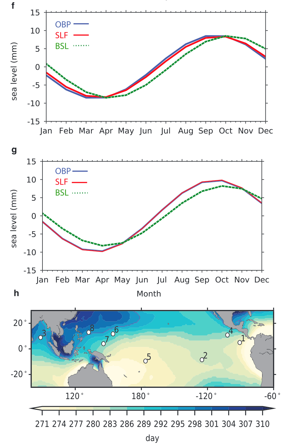 The figure show the best fitted annual signal of sea level from ocean bottom pressure recorder measurements
(blue line in Figures f and g) match well with sea level fingerprint (red line in Figures f and g) at (f) station 1 and (g) station 2 but deviated from barystatic sea level (green dotted line in Figures f and g) with 95% significance. (h) Location of OBP stations 1–8 (white dots) superimposed on the phase of the annual sea level fingerprint signal. Blue contour is the phase of the barystatic sea level.
The figure show the best fitted annual signal of sea level from ocean bottom pressure recorder measurements
(blue line in Figures f and g) match well with sea level fingerprint (red line in Figures f and g) at (f) station 1 and (g) station 2 but deviated from barystatic sea level (green dotted line in Figures f and g) with 95% significance. (h) Location of OBP stations 1–8 (white dots) superimposed on the phase of the annual sea level fingerprint signal. Blue contour is the phase of the barystatic sea level.
Let me know what you think of this article on twitter @Hsu_Chia_Wei!